
Inbox
| Background | Summary | Deliverables | Dataset | Recognition and Prizes |
Background
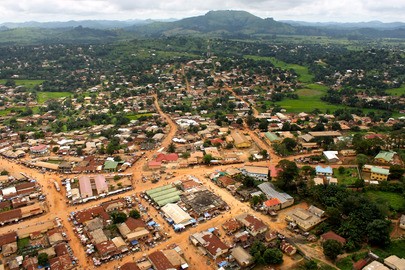 UN Photo/Ari Gaitanis UN Photo/Ari Gaitanis |
Achieving the global goals for sustainable development while leaving no one behind requires a continued commitment to evidence-based policy analysis. Fortunately, new datasets are being released which can improve the global community's understanding of what it will take to meet development challenges. Our task is to improve our ability to use these existing and new datasets for more valuable policy insights. Exploration is facilitated not just by the quantity of data available, but also how easy the data can be combined to test hypotheses. Building a better interface combining various data sources will ease the exploration of relationships that are otherwise difficult to identify and understand, such as how administrative boundaries limit or magnify socio-economic progress, how eco-zones affect economic vulnerability, how distance is related to policy effectiveness, how remote sensing data can be used to close data gaps, and many others. Using data from USAID's Demographic and Health Surveys (DHS) Program as a foundation, including its expansive and detailed estimates of health and demographic indicators which were recently released as modeled surfaces, this challenge will expand the use of data sources and creative visualizations in understanding the role of policy for sustainable development. It will accomplish this by improving the ease of matching household survey data with other geo-referenced datasets and by presenting this combined data in meaningful and innovative ways. |
What is the task?
|
Part 1 Combine the data |
Part 2 Explore |
Part 3 Present the results |
|
Use the newly released DHS interpolated surfaces and/or the DHS Program API data based on available household surveys (which include spatial information) to combine DHS data with other georeferenced datasets in an innovative way, to help further explore the progress in the SDGs. Links to the DHS modelled surfaces and the DHS API, together with examples of additional datasets can be found in the section on 'Data', below. Example 1: combine data from interpolated maps of "population living in households using an improved water source" with poverty mapping, access to electricity, and distance to cities and roads. Example 2: combine satellite maps of night lights, population density, access to electricity, and data on health and mortality. |
Use your combined dataset to explore and analyze the status and trends of SDG indicators you select. A specific focus on Least Developed Countries should be included. Example 1: illustrate how access to education and access to improved water source are related, with the specific focus on LDC countries and sub-national areas. Example 2: illustrate how rainfall relates to health and child nutrition over time, with the specific focus on LDC countries and sub-national areas. |
Visualize the status and trends of the SDG indicators which you selected. |
Deliverables
Your challenge submission must include the following materials:
- Visualization of the results- A web link (URL) to a working (live) demo (suggested: GitHub Pages or BitBucket Pages, or similar). The web front-end should make use only of HTML, javascr1pt and stylesheets.
- Code- A repository of the original open source code, data files, and other electronic files (include GNU license). This package can be hosted in a public repository and should allow OICT or UN Member States to run the tool on local servers.
- Documentation- A brief document describing the functionalities and explanation of the method and the approach taken to solve the challenge
Datasets
DHS modeled surfaces- The newly released (October 2016) modeled surfaces cover a select list of indicators in the areas of health, wealth, access to public infrastructure, and demography. The modeled surfaces are created with geo-coded cluster information for current and future population-based DHS surveys and a selection of earlier surveys. Currently, the site has 16 countries with up to 15 indicators per country. The countries currently covered are Bangladesh, Cambodia, Congo (Dem. Rep.), Dominican Republic, Egypt, Ghana, Kenya, Lesotho, Liberia, Mali, Namibia, Nigeria, Rwanda, Sierra Leone, Togo, and Zambia. The data originates from surveys conducted between 2013 and 2015. To accompany the new surfaces, DHS has created a guidance document to give users some insights on how the surfaces were created and how they might be used.
- Download the datasets here: http://spatialdata.dhsprogram.com/modeled-surfaces/#
- Participants are encouraged to register an API key by sending an email to api@dhsprogram.com.
- Download the guidance document here: http://dhsprogram.com/publications/publication-SAR14-Spatial-Analysis-Reports.cfm
Other datasets - The participants are also encouraged to incorporate other datasets they deem to add value for their submission. Examples of such datasets are (but not limited to):
- LSMS data: http://go.worldbank.org/BCLXW38HY0
- Nightlights data: http://ngdc.noaa.gov/eog/dmsp/downloadV4composites.html
- ArcGIS open data: http://opendata.arcgis.com
- UN Statistics: http://unstats.un.org/unsd/databases.htm
- Flowminder: http://www.flowminder.org/practice-areas/socioeconomic-analysis
- Penn Libraries: http://guides.library.upenn.edu/content.php?pid=324392&sid=2655131
- MIT libraries: http://libguides.mit.edu/c.php?g=176295&p=1161383
- EDEnextdata: http://www.edenextdata.com/?q=content/global-gis-datasets-links-0#Population Infrastructure Topography and Administration Data
- Stanford library: https://lib.stanford.edu/GIS/data
- GIS Lounge: http://www.gislounge.com/data-and-gis-resources/
- dragons8mycat: https://dragons8mycat.wordpress.com/gis-data-sources/
- rtwilson: http://freegisdata.rtwilson.com/
- Planet OSM: http://planet.osm.org/
- Berkeley: http://gif.berkeley.edu/resources/data_subject.html
- Kings College : http://www.policysupport.org/waterworld
- CSRC: http://rslab.sr.unh.edu/gdatalinks.html
- Data Discovery Center: http://ddc.unh.edu/
- Spatial Hydrology: http://www.spatialhydrology.com/datawarehouse.html
- NASA Socioeconomic Data and Applications Center: beta.sedac.ciesin.columbia.edu
- Other possible datasets: Population density and distribution; Existing grid network; Current Road infrastructure; Global Horizontal Irradiation (GHI); Travel time to the closest town.
Recognition & prizes
The winner of the challenge will:
- Receive a letter of recognition from the United Nations Assistant Secretary-General for Economic Development in UN-DESA.
- Be featured at the United Nations Press, the website of Development and Social Affairs website and Unite Ideas platform.
- Be offered the opportunity to have an advisory role in the further development of the submitted solution.
Help to Improve This Idea.